

The Normal Route from Kals to the Grossglockner
The Normal Route to the Grossglockner Glacier is divided into four different stages, starting at the Lucknerhaus and culminating at the summit.
From the Lucknerhaus to the Stüdlhütte
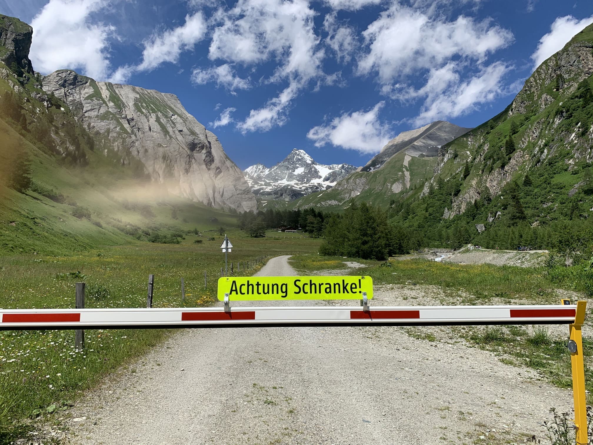
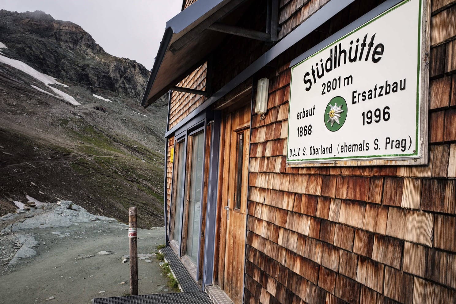
The journey typically begins at the Lucknerhaus, located in Hohe Tauern National Park at 1,920 metres. From here, the summit is already visible as you ascend a steep forest road to the Luckner Hütte. The trail then continues as an easy, well-marked path leading to the Stüdlhütte. Most climbers choose to spend the night here, and for a good reason. At 2,802 metres, it offers a comfortable altitude for those not fully acclimatised, while keeping the final stage to the summit manageable at 1,000 metres of elevation gain.
An alternative is the Erzherzog-Johann-Hütte, Austria’s highest mountain hut at 3,454 metres. Unfortunately, this very fact could be your undoing, because without proper acclimatisation, the night can be restless and far from restorative.
From the Stüdlhütte to the Adlersruhe
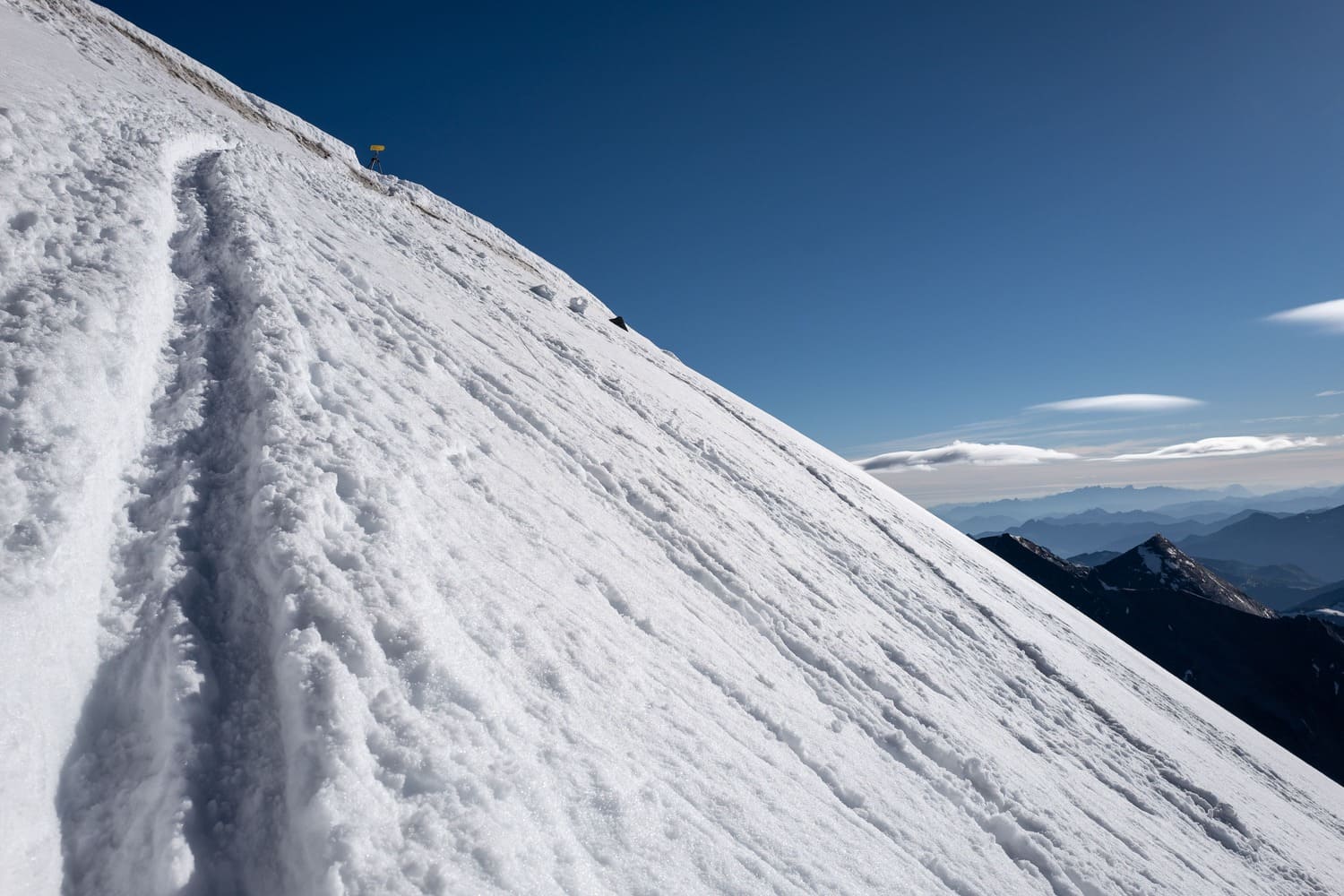
You set off early the next morning from the Stüdlhütte. By the light of your head torch, you navigate the steep terminal moraine of the Ködnitzkees on a narrow path. Due to climate change, the glacier itself has all but vanished, but the loose ground tells the story of its eventful past. The scree slopes are steep, sometimes icy, and require caution and sure-footedness. Like many glaciers on the Glockner, the Ködnitzkees is retreating year after year at an ever-increasing rate. At around 3,000 metres, it’s advisable to put on crampons, unless snow conditions are exceptionally good. And while you’re at it, you should also put on your climbing harness.
The Ködnitzkees is relatively flat and mostly free of crevasses. You follow a broad track towards Kampl. If snow levels are still high, you can bypass the first rocks on the left via a steep firn slope. More commonly, you cross the edge crevasse at the lowest point of the rocks and reach the via ferrata (C). With a few breaks and stretches of easy rock terrain (I), you arrive at the Adlersruhe. Apart from the first section, the via ferrata passages are straightforward (A-B), though bringing a via ferrata set is still recommended. It’s a surreal moment when you step on the hut terrace with crampons, only to find yourself in a cosy dining room moments later. You could almost forget that most of the peaks of the Eastern Alps now lie beneath you.
From the Adlersruhe to the Kleinglockner
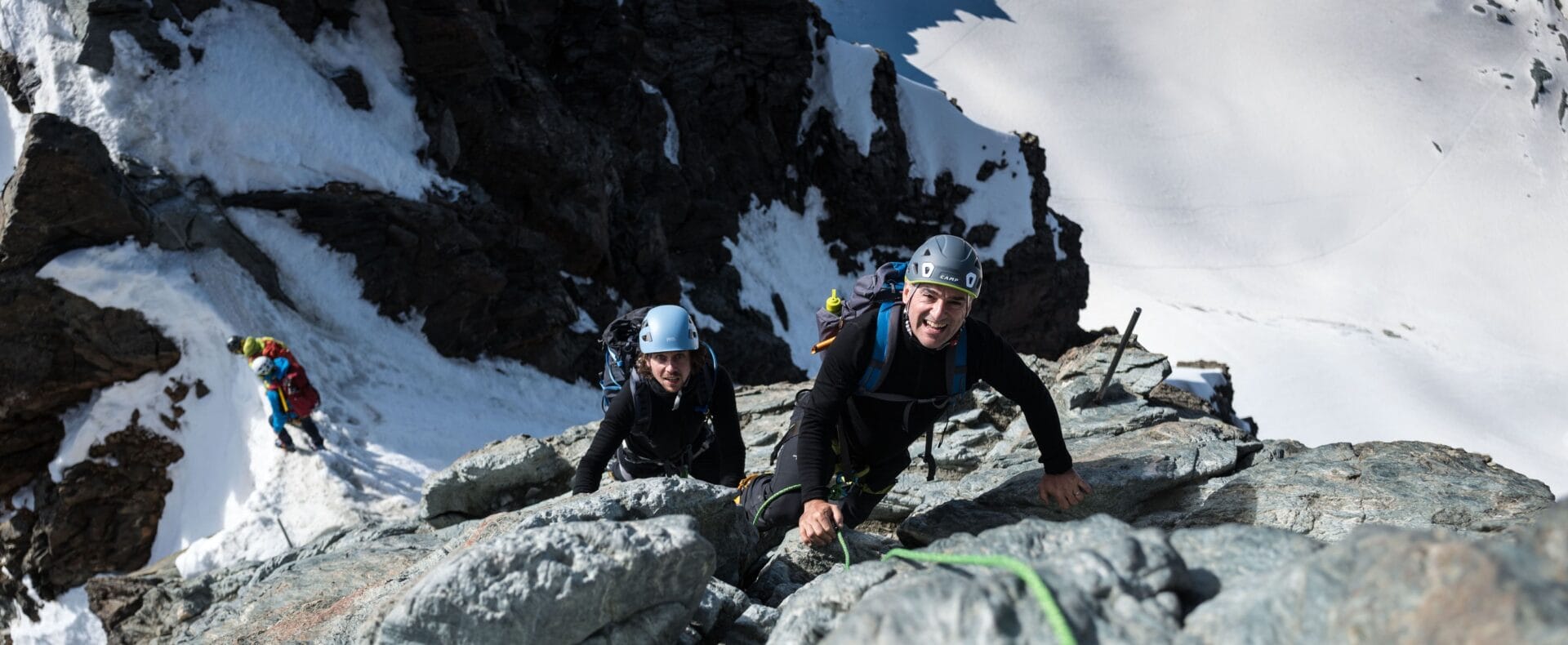
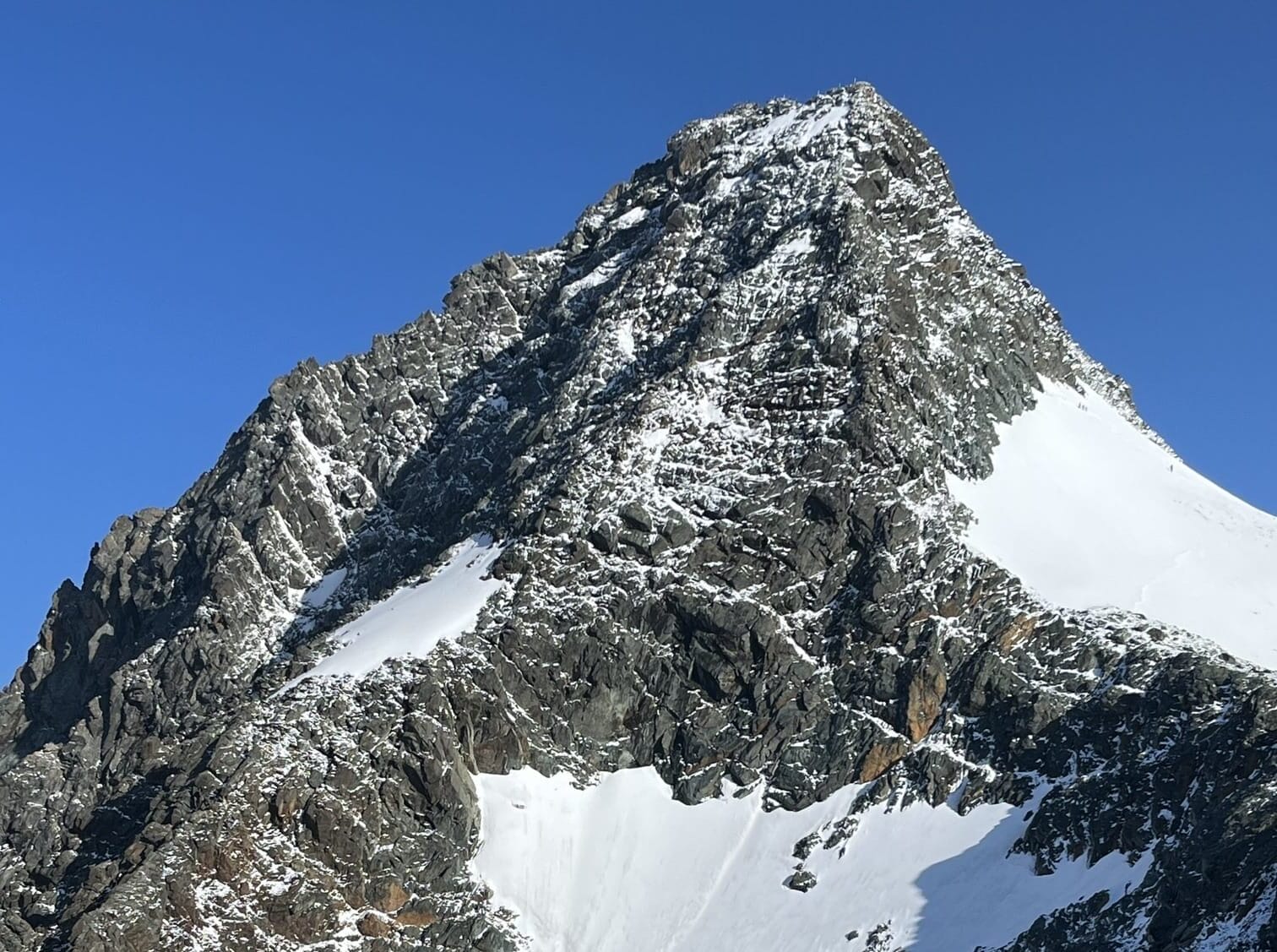
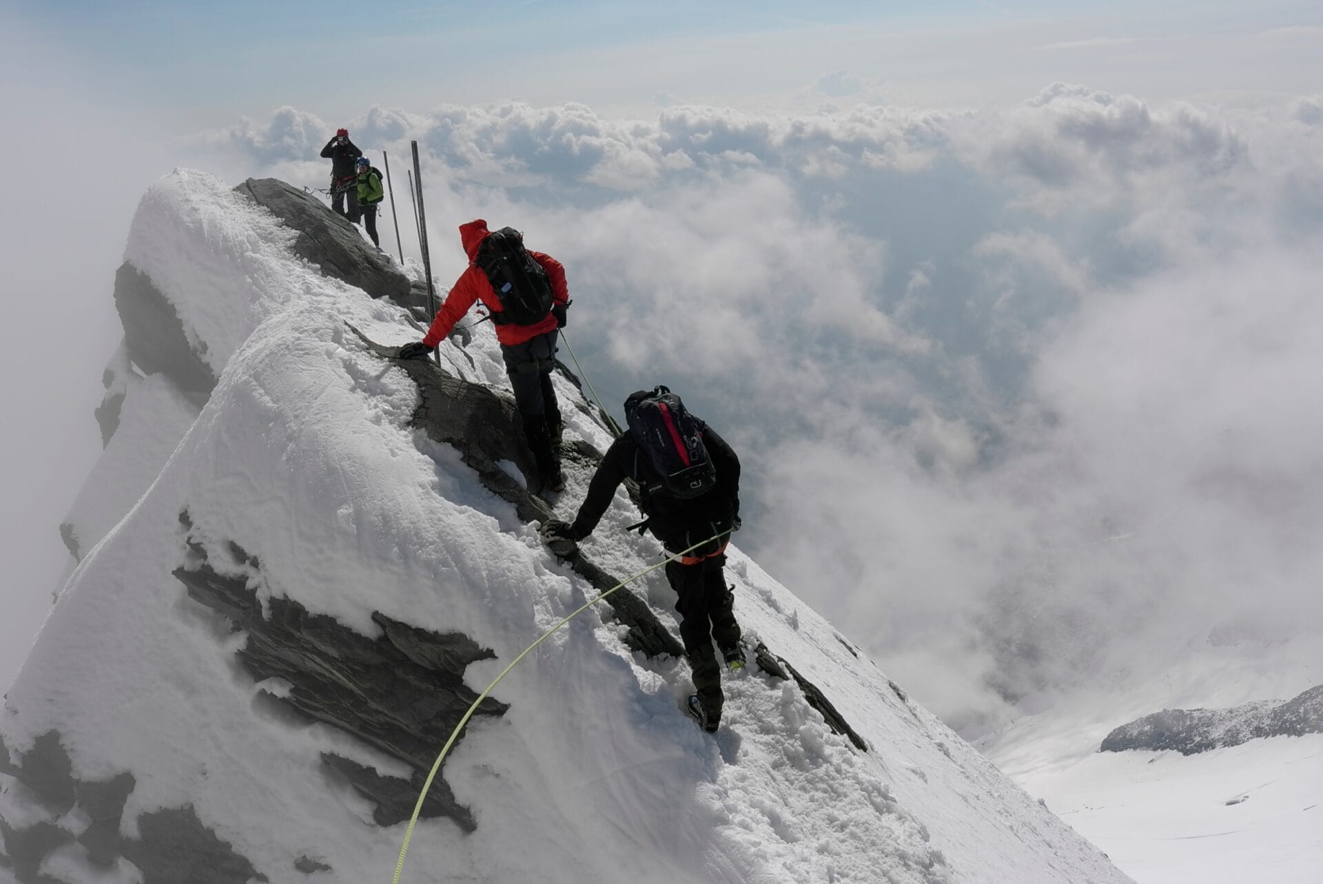
Equipped with crampons and roped up, you head towards the steep summit. From this point, it’s hard to believe the Normal Route involves ‘only’ grade II climbing and snow or ice gradients up to 40°. Yet the path, first discovered in 1800, cleverly exploits the mountain’s natural weaknesses. Snow usually lingers until early August, and a well-trodden path leads to the Glocknerleitl. The Glocknerleitl was once a steep snow gully with a 40° incline, leading to a shoulder on the Glockner’s southeast ridge. Due to continuous snowmelt, the snow gully has transformed into a nasty mixture of bare ice, scree and rock.
Mountain guides from Kals, who lead hundreds of tourists to the summit each summer, have worked to make this tricky section easier with bolts, iron pins and fixed ropes. Still, from mid-summer onwards, this part is difficult and requires solid crampon technique on bare ice and mixed terrain. Once you’ve conquered the Glocknerleitl, you can enjoy an exhilarating climb over firm rock. Safety bars, spaced every 15 metres, guide you to the Kleinglockner. As the difficulty decreases and the terrain flattens, the final stretch to the exposed 3,770-metre summit is within reach.
Via the Glocknerscharte to the Grossglockner
Depending on the season, the Kleinglockner is either a narrow ridge covered in snow and ice or an even narrower ridge of exposed rock. Traversing it feels like walking a tightrope, balancing over one of the highest points in the Eastern Alps. If you’ve made yourself familiar with the route beforehand, then you’ll know that the short but challenging descent into the Glocknerscharte is up next. A fixed rope and good belaying options will take you down to the saddle, which is only a few metres wide. To your right, the Pallavicinirinne seems to plunge vertically into the depths. It was first climbed on 18 August 1876 by Alfred Graf von Pallavicini. His three mountain guides, Johann Kremser, Georg Bäuerle, and Josef Tribusser, famously had to carve thousands of steps into the 55° slope.
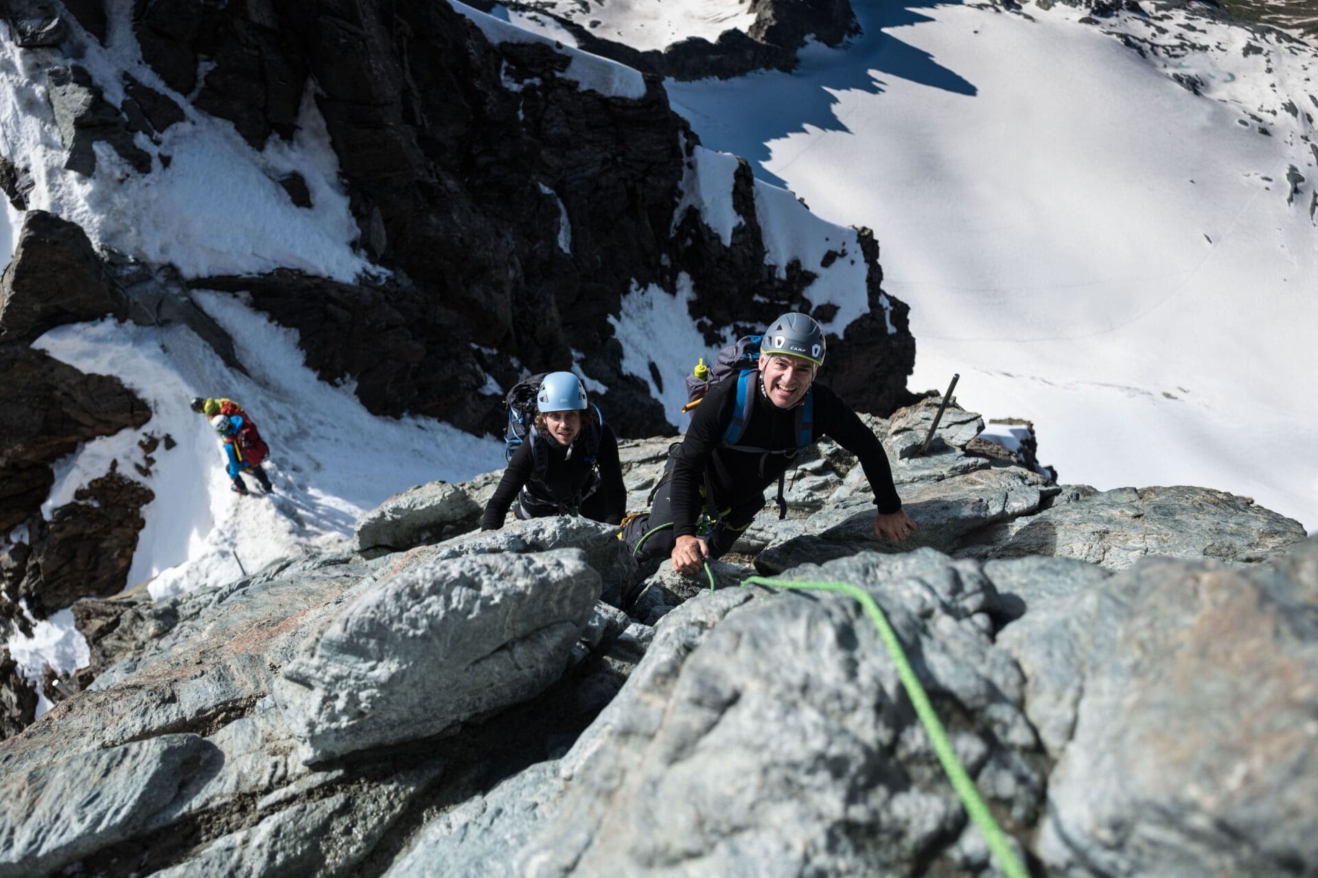
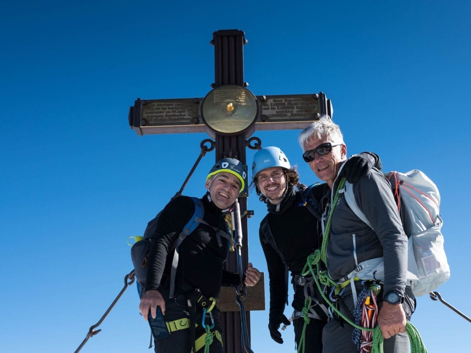
Like the Glocknerleitl, the Pallavicinirinne has suffered from significant glacial retreat and is now rarely attempted in summer. After the saddle, you face the technical crux. Fortunately, the rock is solid and offers excellent grip. If your fitness level allows, then the final metres to the summit cross at 3,798 metres are exhilarating. Here, you also come across the Stüdlgrat, which leads directly from the hut of the same name to the summit. It’s more demanding than the Normal Route and features climbing passages up to upper grade III difficulty. Even more difficult and longer is the Nordwestgrat (IV+), which ascends from the Glocknerwand.
Descent via the Route Taken by the First Climbers
Regardless of the ascent route you choose, the Normal Route described above is a good option for the descent. It’s the easiest route, relatively short, and with a refuge hut just 300 metres below the summit. From the Adlersruhe, there are several descent options available.
If you still have some energy reserves left, I recommend taking the ‘Weg der Erstbesteiger’ (Path of the First Climbers). It’s hardly any more difficult than the ascent via the Ködnitzkees, but it’s far more varied and offers magnificent scenery. Heading southeast, you descend over a mix of scree, snow, and ice toward the Hohewartscharte at 3,182 metres. Steel cables and iron pins guide you down the steep flank into the moraine, the remnants of long-melted glaciers. At 2,644 metres, you’ll reach the Salmhütte, an excellent place to rest and refuel. Alternatively, you can continue for another hour on well-marked, easy mountain trails to the Glorerhütte at 2,642 metres. From there, it’s a final 700-metre descent to the starting point at the Lucknerhaus. Then, you’ll have completed one of the most spectacular high-altitude tours in the Eastern Alps.
Requirements for Climbing the Grossglockner
Climbing the Grossglockner requires:
- Sure-footedness
- Crampon and climbing experience up to grade II. You’ll often be climbing rocky passages with crampons, so confidence in handling such terrain is essential
- Above-average fitness for the 1,000 metres of ascent and 1,900 metres of descent
Good to know:
- If you’re climbing with a mountain guide, then sure-footedness, a head for heights and the appropriate fitness level for a 1,000-metre ascent and a 1,900-metre descent are sufficient
- Particularly fit mountaineers can also climb the Grossglockner as a day tour starting from the Lucknerhaus car park. To do this, you need to be fit enough to handle 1,000 metres of ascent and 1,900 metres of descent, with sufficient energy reserves and the technical skills required for rock and ice climbing
Grossglockner Ascent: Key Facts at a Glance
Valley base: Kals am Grossglockner
Starting point: Lucknerhaus (accessible via toll road, paid parking available)
Base camps: Stüdlhütte, Erzherzog-Johann-Hütte, Salmhütte, Glorerhütte
Difficulty: Demanding high-altitude alpine tour starting from the Stüdlhütte: 1,000 metres of elevation gain on the ascent (4 hours) and 1,900 meters on the descent (5 hours)


