
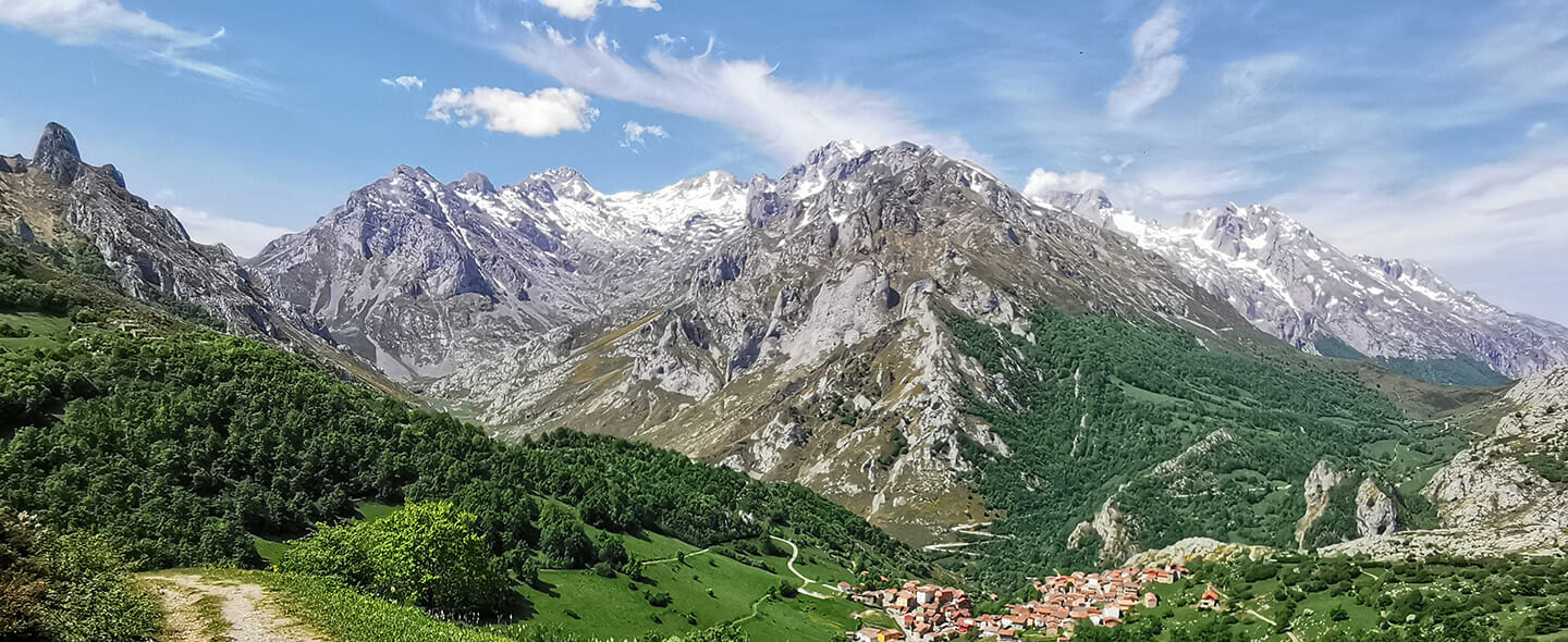

The Picos de Europa were given their name by seafarers sailing to the Bay of Biscay. These towering mountain peaks close to the Atlantic coast were the first things they saw. They’re small and rugged limestone mountains that form part of the long Cantabrian mountain range crossing the whole of Northern Spain.
The area covers about 30 × 30 kilometres, with 200 summits being higher than 2,000 metres. The highest among these is Torre Cerredo measuring 2,648 m. The best known mountain is the distinctive Naranjo de Bulnes rock tower measuring 2,518 m.

What makes the Picos de Europa in Spain so special?
The maximum heights don’t sound terribly impressive but the height differences are immense because many steep peaks tower over valleys and gorges that are just a few hundred metres above sea level.
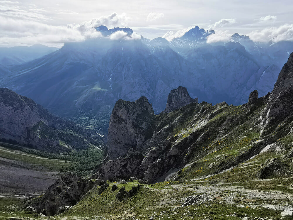
The location right by the Atlantic is also a special feature. The enormous mountainous terrain causes humidity from the sea to rise in the form of clouds, which then produce copious amounts of rain. This results in valleys, gorges and abysses being forcefully carved into the mountain mass.
The water shapes sharp and acute ridges, edges and teeth – as well as numerous holes, gaps and cave systems where the majority of the water is absorbed. During the Ice Age, glaciers also contributed to the formation of deep cirques and recesses.
This intensive “sculpting work” gave the Picos mountains a particular ruggedness and steepness that is not just beautiful to behold but also unsuitable for ski lifts and apartment buildings. That means this amazing landscape is hardly developed and Alpine Trekkers can enjoy the unadulterated magic of this high mountain region.
But the area is by no means just rough and rocky. Lush forests sprawl across the valleys and on less steep slopes, and the cirques boast vibrantly green meadows. Real mountain lakes, on the other hand, are much more rare because of the perforated and porous rock.
The damp coastal climate may seem to be a disadvantage at first but it also has its advantages – more about that in the next section. Proximity to the coast with its beautiful beaches definitely goes into the plus column for a versatile holiday.
With a car or campervan, it’s only about half an hour from pretty coastal towns such as Llanes and Ribadesella until you get to the starting points for Picos de Europa hiking.
Climate and weather
If you believe in the possibility that the mist will disappear… the landscape will surprise you by unfolding its beauty and magical combination of summits and clouds in the sky.
Pedro Pidal
This freely translated quote is from Pedro Pidal, the founder of the Covadonga National Park, which was the predecessor of today’s Picos de Europa National Park. It basically summarizes all the key aspects. In the Picos in Spain, it’s the seemingly bad weather with its rapid and surprising changes that grants unforgettable atmospheres and moments.
Even thick clouds can disappear quickly, giving way to clear air and intense colours. Factually put: los Picos de Europa have a mild and very damp Atlantic climate which is a little drier on the southern side. The micro climate of Liébana, a beautiful valley region in the South East, on the other hand, is sometimes almost Mediterranean.
The changeable weather can also vary locally within a confined area so you will experience different conditions even during a day of touring. In the summer, there may be long periods of nice weather, even though the humidity will still be high enough that hikers need to expect suddenly descending fog (encainadas) when the sky is clear and blue.
Flora and fauna
Vegetation is diverse and clings to the rock faces, which gives the impression of a South American tropical landscape in some places. Coniferous woodlands consisting of beech trees, oaks and many other types of trees dominate the region. On the southern side, Mediterranean tree types can be found, such as holm oaks and cork oaks as well as hollies.
At moderate altitudes, pasture land and scrub with yellow broom take over, complemented by sometimes head-high ferns and heather. The variety of flowers and herbs in the mountain meadows is also vast. In October and November, the woods display a wide range of colours.
With more than 200 vertebrate species, wildlife is also very diverse. You will often spot chamois (rebecos) as well as large vultures and birds of prey. Cuckoos are frequently heard in the forests and you can see lizards disappearing under rocks.
It’s less common to come across Pyrenean ibex, wild boars, foxes, stags and deer. And you’ll practically never spot the indigenous brown bear, wolf or red deer. However, there are cows, goats and sheep everywhere.
People and culture
The mountains have been inhabited for at least 10,000 years. Many of today’s inhabitants are descendants from the Celts who, thanks to the inaccessible terrain, could not be fully subjugated by the Romans or the Moors. The area is still sparsely populated with people predominantly living modestly in remote villages consisting of ancient stone houses.
Their livelihood remains agriculture, mainly offering fine and expensive types of cheese. Until the middle of the 20th century, mining of copper, zinc and other ores was intensively carried out. This no longer plays any role. Its economic significance has been taken over by tourism.
History in the Picos de Europa
In the year 722 AD, the Asturian military leader Don Pelayo beat the Moors in the Battle of Covadonga on the northern edge of the Picos de Europa, beginning the Reconquista, the recapture of Spain that took 770 years according to legend. This battle represents the founding myth of Spain, and the basilica built in its location is a national treasure.
Tourism
It’s mainly the Spanish themselves who visit the Picos mountains and their country’s first national park in greater quantities. And this is largely limited to July and August as well as Holy Week before Easter. These visits also mainly focus on three central areas:
– the Cares Gorge situated between the eastern and central massif
– the Fuente Dé Cable Car leading to the southern high plateau of the central massif
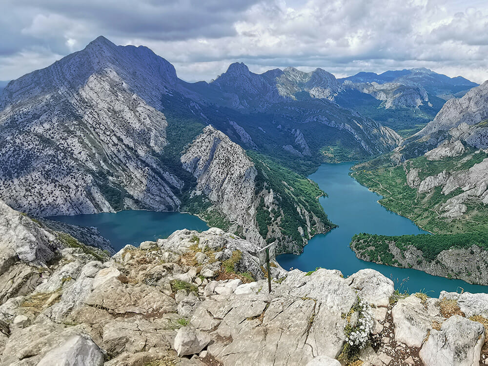
– Covadonga in the North West with its two mountain lakes Lago Ercina und Lago Enol.
There is also a handful of other more frequented routes, such as the hut-to-hut tour to Refugio Urriellu which is located right below the smooth western face of Naranjo de Bulnes. Not much happens outside the season. The rest of the area also only sees limited numbers of visitors.
How to get there and local travel
Coming from Germany by car or camper van usually takes two to three days. Of course, you can take the train to the coast to travel around the Picos using public buses, but this takes up a lot of time. Another option is flying to Santander or Oviedo and hiring a car.
The only efficient bus connections around the Picos de Europa exist in the tourist centres Arenas de Cabrales, Fuente Dé, Potes and Cangas de Onís/Covadonga. And even in these hotspots, the connections aren’t always coveniently timed. Many towns located close to major roads and in side valleys can be reached by bus, but the schedules aren’t tailored to the needs of tourists.
Parking is difficult during the main season but there are fewer prohibitions and restrictions that you may know from other countries. That’s why, if necessary, you can always find an adventurous but legal place to park.
Many starting points for hikes can be reached with a camper van. Unfortunately, it’s the most frequented routes that are the exception because there is no space for camper vans in the narrow access roads and small villages. In these cases, however, there are usually shuttle buses.
Hiking and mountaineering
Because of the great differences in altitude and the “lack of” funiculars, major views in the Picos de Europa often have to be earned with sweat and honest hard work. Even many “low” mountains boast a long ascent with an Alpine flair.
The fact that many paths have fewer signposts as well as fewer markers and are less comfortably maintained, is another difference compared with popular mountain sports resorts in the Alps. In addition, there are harsh contrasts and abrupt changes in landscape, turning paths from easy into difficult and from wide and developed into barely visible within just a few metres.
The Picos mountains are also much less populated and accessible than comparable Alpine regions such as the Dolomites. More attention and active navigation are therefore generally required.
On the other hand, this offers a higher experience value with more originality. In the South East to South West, the southwestern region of Sajambre, is particularly wild, isolated and pristine with jungle-like forests and steep gorges.
Even “pure hikers” in the Picos de Europa in Spain are lucky because they can still see amazing views. Many majestic summits and wild rocky areas can be discovered without climbing skills.
If you’re out and about by car or camper van, I would personally recommend trips where the route travelled to the destination and back is identical. Rescue and recovery missions back to the starting point in the Picos de Europa cost a lot of time and, based on the very present factors of weather and orientation, it’s an advantage if you already know the way back. The weather changes frequently anyway, meaning the views on the return journey are often different.
Maps of the Picos de Europa
For the Picos mountains, quality maps are available, if you know where to look. In the small town of Arenas de Cabrales in the North, practically any map and literature can be obtained. In Potes in the South West, the selection is also good, but limited to poor in the other smaller villages.
Standard are 1:25,000 double maps covering the Picos de Europa National Park in Spain, i.e. the central area with the three major mountains in this range. For areas outside the National Park, maps saved offline or online maps printed out are recommended. In addition to Opentopomap.org, the Czech online map Mapy.cz is a good free alternative.
Save the best for last: 9 + 1 top trips
I have so many personal highlights and favourites among the 55 trips I created for the Kompass walking guide book “Picos de Europa” that choosing just a few is tough. I will ignore the three major tourist attractions because information is easy to find for these.
But this doesn’t mean that these places aren’t worth a visit. On the contrary, all three of them are absolutely worthwhile and are the most visited for good reason. You just have to put up with a lot of other Alpine Trekkers. For this reason, I will point out less well-known trips which are more or less categorised by difficulty.
And by location because they’re spread across the three major mountains:
- Cornión in the West
- the Urrielles in the centre
- the Ándara massif in the East.
This small selection will therefore give a good overall impression of the Picos de Europa.
Cornión:
1. Pica de Ten (1,223 m, easy to moderate): This tasty short trip, via a lot of iron, leads to a small mountain pyramid that looks the same from all sides. Its peak boasts many beautiful views but is overdeveloped. However, its route, which is like a via ferrata in some parts, is highly entertaining. Start and end are a large hikers’ car park located close to an acute bend on the N-625 between Oseja de Sajambre and the Puerto del Pontón Pass.
2. Peña Beza (1,963 m, moderate to difficult): Peña Beza is a cornerstone with lovely views. It’s much more isolated than the neighbouring and easier Pico Jario. The ascent offers variety, rough landscapes and special views. Start and end are the large car park just outside Soto de Sajambre mountain village.
3. Vegabaño round trip (1,321 m, easy): With its park-like forests, this trip is reminiscent of Central Europe. You won’t guess what amazing paradise Vegabaño represents until you’ve actually arrived and its lush green lies before you. This extensive pasture land might be the most beautiful of the Picos de Europa. Start and end of this circular walk are the large car park just outside Soto de Sajambre mountain village.
The Urrielles:
4. Torre Cerredo (2,648 m, difficult): This Alpine mountain tour leads to the true king of the Picos mountains. The summit’s steep slope features exposed terrain and a Grade II climbing section. Very rough terrain will challenge your sense of orientation but offers visual highlights with dramatic high mountain scenes. A helmet is recommended because of the risk of falling rocks. You can climb to this “conventional path” starting in Refugio Jou de Los Cabrones or from the Urrielles hut.
5. Majada de Ondón (1,310 m, moderate to difficult): The steep trip partly covered in scree leads directly to an atmospheric place in the high mountains. Every step is rewarded with a wider and continuously improving view that is unrivalled at the end. Start and end is Camarmeña mountain village with its limited parking around the tiny church.
6. Colláu Cerreu (1,480 m, moderate): The journey to an unbelievable premier location above the “divine” Cares Gorge is easy from a technical point of view but very long and sometimes exhausting. The tour leads through gorges and “canales”, ultimately across the Amuesa high plateau to this spectacular yet isolated destination. Start and end are deep down by the Río Cares, between Poncebos and Puente de la Jaya.
7. Peña Vieja (2,619 m, medium): With its expansive views, this big mountain requires a lot of effort but few technical skills when you’re ascending paths that are often covered in scree. The “El Cable” summit station with the “Teleférico de Fuente Dé” cable car is the perfect starting point high up. From there, it takes just a few hours to ascend via the Canalona Canal and the north western face.
Ándara:
8. Pico Macondíu (1,999 m, moderate): The elegant pyramid is the most northern guardian of the eastern massif, offering stunning views. The summit can be reached on an atmospheric trip through barren mountain scenery via the Ándara hut. Behind the hut, you ascend the southern ridge via brief steep rope sections and quite exposed areas. Start and end point are the large hikers’ car park close to the Jitu Escarandi Pass.
9. Corral de los Morros (600 m, easy): This relaxed stroll along an impressive mountain ridge via the Hermida Gorge and the formidable valley region of Liébana only takes half an hour. You will be surrounded by breathtaking rocky peaks like Peña Ventosa. Start and end are the car park close to the football field behind Pendes.
10. Insider tip: Pico Gilbo (moderate to difficult): This edgy summit is located to the South in the rugged Sierra de Riaño and can only be included as part of the Picos de Europa in the broader sense. But the unique landscape around the “fjords of León” is worth a diversion. The view from Gilbo peak will take your breath away. Because of some exposed climbing sections, the ascent via the western ridge is classified as demanding but only takes around two and a half hours.
Some of these trips can be found on Komoot or Hikr. But if you want current and clearly described instructions, please use the comprehensive Kompass walking guide book (2023) ;-). In addition to these trips, it contains another 45 routes as well as many tips, tricks and practical detailed information.


