

The Black Forest is located in the South West of Baden-Wuerttemberg and, with Feldberg Mountain (1,493 m) in the South as well as Hornisgrinde Mountain (1,164 m) in the North, is the highest contiguous low mountain range in Germany. The countryside has everything to offer from wooded mountains in the North and expansive meadows in the central part of the Black Forest to high, treeless hilltops in the South. Whether adult or child – with lakes, rivers, waterfalls, moor, gorges, valleys rich in forests and meadows, summits, castles and Black Forest farm houses that characterise the landscape, the region is perfect for outdoor enthusiasts who want to explore hiking trails and experience adventure. The high mountains, low valleys and dark forests conjure up a special atmosphere that lets your imagination run wild when Black Forest hiking. It’s therefore no surprise that the dark and, at the same time, seemingly magical Black Forest is said to be the inspiration for several fairy tales.
Hiking trails in the Northern Black Forest
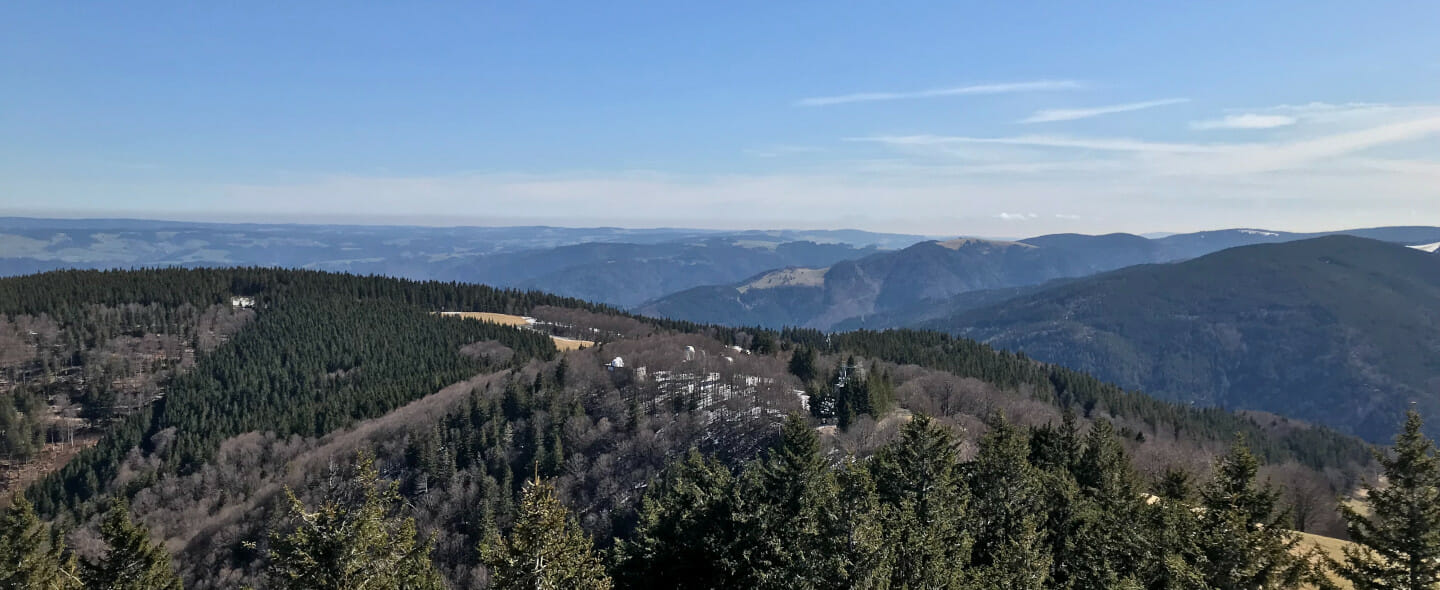
Hike to Hornisgrinde Mountain and Mummelsee Lake
On this Black Forest hike to Mummelsee Lake, you will get an extensive view of the landscape when you’ve climbed Hornisgrinde Mountain. You will be able to see the Ortenau region, the Vosges Mountains and the Swabian Alps towards the East. Even the Alps are visible from there.
The hike starts in Sand in a car park close to Sand Chapel. The first section leads high up to Hundseck Restaurant along the Western Trail which is marked with a red diamond. You’ll then continue up the Western Trail to Hochkopf Mountain. You’ll get a stunning view into the distance there before returning down towards Murkopf Mountain. The path runs along the eastern slope of Murkopf to Ochsenstall Skiing and Hiking Hostel. That’s a great place to refuel before going up to Hornisgrinde Mountain, the highest point in the Northern Black Forest. Once you’ve arrived at the top, the two viewing towers Bismarckturm and Hornisgrindeturm give you the opportunity to marvel at the magical scenery. The last part of the path then takes you to Mummelsee Lake. From the bus stop outside the Berghotel, return to Sand by bus.
Distance: about 11 kilometres
Pure walking time: around 3.5 hours
Schliffkopf Mountain and River Murg source hike
Schliffkopf Mountain (1,055 m) is situated in the Black Forest National Park close to Buhlbach. The uppermost springs of the Murg originate on the eastern side of Schliffkopf. On the summit, you’ll get an amazing panoramic view of the Northern Black Forest’s scenery. Schliffkopf Mountain itself is characterised by forest and heathland as well as streams. You can explore the area around Schliffkopf on forest tracks and steep paths with roots, and the source of the Murg isn’t far either.
The hike starts in Steinmäuerle hikers’ car park next to the Black Forest flyover. Climb up to Schliffkopf from here. When you’ve reached the top, a display shows you everything you can see in the distance. On the way down, you’ll pass Höllbrunnen Well before reaching the “Roter Schliff” fork. Then descend towards Hubertushütte Hut. You’ll then go along the slope of Langer Zinken Mountain. Cross Tränkenteich Brook where you can take a diversion to the source of the Murg. You’ll then return to Steinmäuerle hikers’ car park.
Distance: about 7.3 kilometres
Pure walking time: around 2 hours
Lothar Path
Lothar Path is located close to Schliffkopf. If you have time or you want to see more of the area, you can take a diversion to Lothar Path. On this adventure path, you can see how nature develops without human intervention after a storm. In 1999, Hurricane “Lothar” blitzed through the Northern Black Forest and left a lane of toppled and uprooted trees. Today, you can see young trees growing and how dead timber plays an important role for insects, plants and fungi. The adventure path includes walkways, ladders and steps. There’s also a viewing platform that offers an impressive panoramic view of the Northern Black Forest.
Distance: about 0.64 kilometres
Pure walking time: around 45 minutes
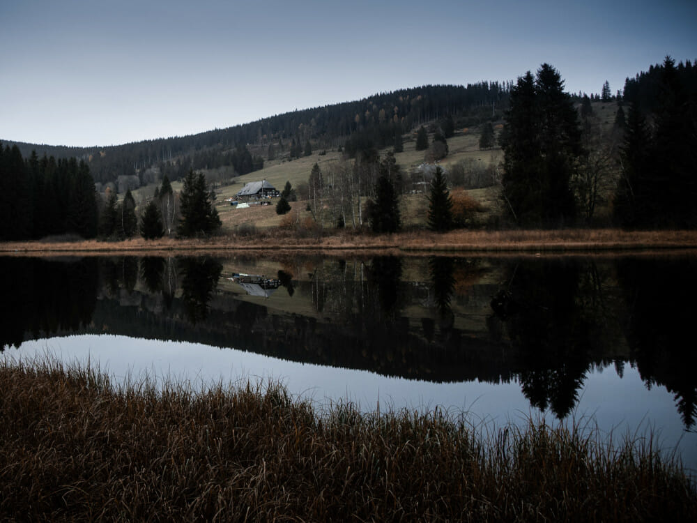
Circular hike including Schwarzenbach Dam and Herrenwieser Lake close to Forbach
Schwarzenbach Dam is the biggest reservoir in the Northern Black Forest. There is a circular walk around the lake measuring around 6.5 kilometres. It starts at the dam and runs along the lake edge on its northern shore, returning through the forest on the southern side. On the trail, there are display boards giving information about the construction of the dam and the technology to generate power.
Distance: about 6 kilometres
Pure walking time: around 45 minutes
If you want to extend the circular walk, you can take a diversion into more elevated terrain and visit Herrenwieser Lake. On the northern side, the path leads steeply uphill towards Seebachhof Farm, then along Seebach Stream to Herrenwieser Lake. One of the most beautiful cirque lakes in the Northern Black Forest, it’s protected as a natural monument. The cirque wall that can be found there is the highest in the Northern Black Forest, at 170 metres. In an easterly direction, you go downhill towards Herrenwies Hiking Hostel, then back to Schwarzenbachtal Dam across the splash dam. To start this walk in the Black Forest, you can park in Schwarzenbach Hotel’s car park. There’s also a bus stop nearby.
Distance: about 12.5 kilometres
Pure walking time: around 3.5 hours
Circular hike Schwarzmiss Pass, Hohlohturm Tower, Toter Mann and Hohlohsee Lake
On this hiking trail in the Black Forest, you will get an amazing view of fascinating moor landscape.
Start in Kaltenbronn “C” hikers’ car park next to Schwarzmisshütte Hut. The trail first leads to Hohlohturm Tower. This viewing point offers an extensive vista of the Northern Black Forest. The Vosges Mountains, Palatinate Forest, Odenwald Forest and the Swabian Alps can also be seen from up there. On a clear day, you can even spot the Alps and Feldberg Mountain. The path then continues towards the South past Prinzenhütte Hut located on Toter Mann Hill. From there, follow the Black Forest Cycle Path until it turns off into Torfweg Path. On Torfweg Path, continue into Breitlohmiss moorland where you will reach Hohlohsee Lake. Then return to the start via Hohlohturm Tower.
Distance: about 14.3 kilometres
Pure walking time: around 4.5 hours
Gernsbach Trail of Legends
The signposted circular hike starts at Klingelkapelle Chapel (185 m) in Gernsbach, taking you past seven stopping points around Gernsberg Mountain where you can hear legendary stories. Klingelkapelle Chapel also has an interesting history. Accompanied by hermits, angels, dwarves and other creatures starring in these fables, you’ll be entertained well on this gentle walk that has a slight incline at the beginning.
From Klingelkapelle Chapel, you’ll head towards Eberstein Castle on a narrow zig-zagging track up to Engelskanzel viewpoint (250 m), the second stopping point on the Trail of Legends. Continue towards Luisenruhe. You’ll reach Hildaweg Path and follow it uphill. Keep going towards Wachtelweg Path. On this path, you can take a diversion to Wachtelbrunnen Well (280 m). Return to Wachtelweg Path and on to Grafensprung (210 m), followed by Murgtalblick to Eberstein Castle (304 m). The Trail of Legends continues to the ore mine (262 m), the sixth stopping point on this circular walk. It’s said that this is the entrance to the underground palace populated by little creatures that protect an enormous treasure inside. Continue on Erdmännlespfad Path on to Forlenkopf. The last stopping point is Rockertweible (250 m). A narrow path leads to Klingelkapelle Chapel, the starting point of this enjoyable circular hike.
Distance: about 5.3 kilometres
Pure walking time: around 2 hours
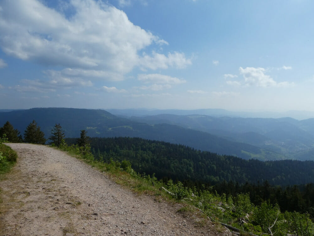
Hiking trails in the Southern Black Forest
Circular hike on Feldberg Mountain
Feldberg is the highest mountain in the Black Forest. Its unique views in all directions are very impressive. You can expect trails that are sometimes steep and rocky as well as narrow paths. Sturdy footwear, appropriate outdoor clothing and surefootedness are required.
This hike starts at Feldberg House of Nature, followed by a steep ascent to Feldberg Tower and to the Bismarck Monument. After that, descend to Raimartihof Farm. This place is perfect for a little rest. You’ll then pass Feldsee Moor before reaching Feldberg Lake. The view is amazing here because the glacier lake is surrounded by imposing rock faces. At the end, you’ll wind your way down through the forest and back to the House of Nature.
Distance: about 9 kilometres
Pure walking time: around 4 hours
Black Forest Bread Trail
This leisurely hike features varying landscapes and you’ll learn a lot about the life of farmers as well as baking bread in the Black Forest. Display boards outside the farms provide information about when the relevant farms bake bread. On the farms dotted around Yach Valley, the art of baking bread has been mastered over centuries. The Bread Trail connects these farms.
Start in Elzach/Yach hikers’ car park opposite the church. First, you’re walking in the Black Forest towards Bierhäusle Pub where the track inclines slightly as you get closer to the edge of the woods. Continue to Schneider Farm. When you’ve followed the Bread Trail for some time, you’ll pass Tränkleshof Farm, you’ll descend to Rauchengrund village, reaching Bernhardenhof Farm. From here, the trail leads to Yach. You’ll pass Schätzlehof Farm, then Bierhäusel Pub again before returning to the hikers’ car park.
Distance: about 11.5 kilometres
Pure walking time: around 3.5 hours
Hike through Löffeltal Valley and Ravenna Gorge
With the Ravenna Bridge measuring 37 metres in height, two waterfalls and adventurous paths running right alongside steep rocks, this hike is a very special experience.
Start at the railway station in Hinterzarten. Passing the spa building and adventure playground, turn right before the bridge towards Löffeltal Valley. Follow the red and white diamond on the hiking trail towards Löffeltal Valley/Ravenna Gorge. Soon, you’ll reach the entrance to Löffeltal Valley. Between Rotbach and the railway tracks of the Höllentalbahn, you’ll pass small, old mills. After about 2 kilometres, a signpost will direct you to Ravenna Gorge. Once you’ve gone through a small underpass, your next intermediate destination will be Hofgut Sternen Manor Farm. You can watch glass blowers at work here or take a break at the restaurant.
Behind the building, continue to Ravenna Gorge and then on to the imposing Ravenna Bridge. You’ll walk underneath the bridge and descend, following the stream bed to the next bridge. Steep steps and timber bridges will lead you back up. After the Great and Small Ravenna Waterfalls, you’ll reach Großjockemühle Mill. This is followed by Löffelmühle Mill. Next to Löffelmühle Mill, you’ll have a chance to rest at Ketterer Restaurant. Behind the restaurant, a small bridge will lead you to Hinterzarten. You’ll then return to the starting point.
Distance: about 7.8 kilometres
Pure walking time: around 3.5 hours
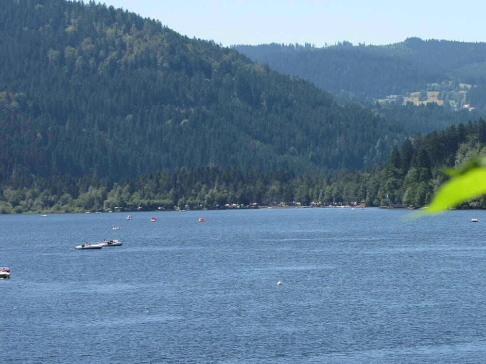
Schluchsee and Rothaus circular hike
This hike goes from Schluchsee Lake to Grafenhausen-Rothaus and back via Seebrugg. On the journey, you can take a diversion to “Hüsli” museum of local history which was originally commissioned in 1911 by Berlin’s concert singer Helene Siegfried as a luxurious holiday home. Later on, it rose to international fame as the home of “Professor Dr. Brinkmann” in the TV series “Schwarzwaldklinik”. Rothaus Brewery is also a popular destination for excursions. You may enjoy a “Zäpfle”, a freshly drawn beer, and indulge your palate at the brewery’s restaurant.
This circular hike starts at the town hall in Schluchsee and goes to Seebrugg, then on to Faulenfürst on a hiking trail that is marked with a yellow sign. You’ll then reach the town of Dürrenbühl, followed by Rothaus Brewery which you’ll go round on Zäpfleweg Trail. You’ll continue towards “Hüsli” past the brewery’s restaurant. Next, you’ll go through Brünlisbach. Passing the camp site, walk along River Mettma to Seebrugg. At Seehotel Hubertus Hotel, cross the road and continue on the forest track towards Schluchsee until you reach your starting point again.
Distance: about 15 kilometres
Pure walking time: around 4.5 hours
Todtmoos Lebküchlerweg (Gingerbread Women Trail)
In previous centuries, the women of Todtmoos used to supply pilgrims with gingerbread when they ascended to “Our Blessed Lady of Todtmoos” pilgrimage church. These women were given the name “Lebküchler”. The inhabitants of Todtmoos are still referred to by this name in the region. There is a lot to see on Lebküchler Trail. Gorges, waterfalls, meadows, farms and viewpoints are just some of the features you’ll come across. Benches and sunbeds provide many opportunities to stay and rest for a while. Your ascent is manageable so you can fully enjoy the journey.
The hiking trail starts at the swimming pool in Todtmoos, passes Rabenschlucht Gorge and then goes uphill via Schwarzer Felsen to Scheibenfelsen Mountain (974 m). Continue to the district of Lehen and up to Hochkopfhütte Hut. You’ll soon reach Hochkopfhaus Hotel. Walking along comfortable footpaths, you’ll pass Liebfrauenbrunnen Well, reaching Rütte Pavilion that features a shelter, well and barbecue area. You’ll then wind your way down into the gorge of Rüttebach Stream. Passing waterfalls, continue to the district of Rütte. Below Rütte, the hiking trail meets Todtmoos Waterfall which you’ll cross via a bridge. Steps will lead you to Strick with its beautiful chapel and the much-acclaimed Rößle Hotel Restaurant, then back to the beginning of Rabenschlucht Gorge and the starting point of the hike.
Distance: about 13.8 kilometres
Pure walking time: around 4 hours
Titisee Lake, Hinterzarten and Adler Ski Stadium circular walk
The hike begins in Titisee, goes through Winterhalde, past Adlerweiher Pond and on to Adler Ski Stadium. You’ll return to Titisee by walking through the forest.
The journey starts at Titisee Spa Building. Walk down to the spa garden and cross the road by the bathing area where you enter the woods. Stay left until reaching Titiseee Fairground. When you get to the fork, follow the path uphill. Once you’ve reached the top, you can see Jockelehof Farm below you. Go along Winterhaldenweg Path until you get to a crossroads. Turn left and immediately right onto Bergackerweg Path. Leave the road by turning right at the first crossroads. This will take you to Adlerweiher Pond, followed by the railway station. This is where you decide whether to take the train or to hike back to Titisee. If you continue hiking, your journey will take you past Parkhotel Adler to Adler Ski Stadium. When you’ve reached the Ski Jumping Centre, go up to Scheibenfelsen and the start tower of the ski jump. From there, Pforzheim-Basel Western Path (red diamond) takes you back to Titisee.
Distance: about 9.5 kilometres
Pure walking time: around 3 hours
Hikes for children
Treetop path, “The Cold Heart” fairy tale hiking trail and suspension bridge on Sommerberg Mountain
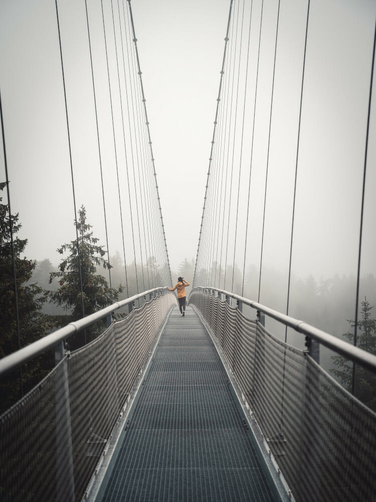
For children in particular, the treetop path, fairy tale hiking trail and the WILDLINE Suspension Bridge on Sommerberg Mountain close to Bad Wildbad are absolute highlights when walking in the Black Forest.
Once you’ve paid the entrance fee, you can head along the treetop path. On the way to the viewing tower, there are various stops where you can show off your climbing and balance skills. You’ll also learn about flora and fauna in the Black Forest. When you’ve reached the very top of the tower at a height of 40 metres, you’ll get a unique 360 degree view of the imposing woods and valleys of the Black Forest. After fully enjoying the vista, you’ll have the opportunity of sliding to the exit down a 55-metre tubular descent. That sounds like great fun, doesn’t it? :)
If your children haven’t had enough, continue to the adventure forest. This action playground covering 8,000 square metres features all sorts of activities for young and old, guaranteeing entertainment for the whole family. You also have to pay an entrance fee here.
Experiencing a fairy tale
The “The Cold Heart” fairy tale hiking trail also starts at the exit of the treetop path. On a journey of 3.2 kilometres, the fairy tale “The Cold Heart” written by Wilhelm Hauff is told. It’s about young Peter Munk struggling for his happiness. The fairy tale includes a small glass imp – a benevolent forest spirit that grants him three wishes – and Dutch Michel, a huge chap with wide shoulders who gets Peter’s heart in a trade. Delve into the fairy tale with 10 stopping points featuring audio books and display boards along the way. You’ll also learn a lot about the Black Forest. Raft-making, trees, geology, giants, mermaids, knights, glass production in the Black Forest and Black Forest Specialities are topics mentioned on this trail. This circular trail ends at the viewing tower.
At the end, you can take a diversion to the WILDLINE Suspension Bridge. It costs money but you’ll see something very special. The only suspension bridge of this kind in Europe, it’s designed upwards in an arc shape. Plus, you’ll get a stunning view into the depth from the suspension bridge.
Troll Path – children’s adventure trail close to Kaltenbronn
The starting point is Kaltenbronn “F” hikers’ car park. A picture of a wood grouse will lead you along the adventure trail that teaches you about nature. One part of the trail is Troll Path, which has been specifically designed for children. Children then have the task of chasing evil trolls through the woods and catching them. They have to solve riddles, and white trolls along the way help them to find the next stopping point. Troll Path leaves the main trail in some sections but keeps returning to it. You can continue to Wildsee moorland and you’ll reach the edge of the impressive moor via a wooden footbridge. Return along the same way. After the hike, you have the opportunity of taking a diversion to the game reserve behind Kaltenbronn Info Centre.
Distance: about 5 kilometres
Pure walking time: around 3.5 hours
Hohengeroldseck Castle Ruin hike
The impressive Hohengeroldseck Castle Ruin (524 m) is situated on a mountain peak close to the mountain pass between Kinzigtal Valley and Schuttertal Valley. Expect a long, moderate to steep ascent rewarding you with great views at the top. The return journey is more leisurely.
The hike starts in the car park next to the cemetery in Reichenbach. Go along the western slope of Eichberg Mountain on Kapellenweg Path. Then you’ll drop down into the valley of Talbach Stream. Continue to Weiler and on to Geroldseck. Now go up to the ruin. On the way back, keep left at the crossroads in Geroldseck, returning to Reichenbach along the south eastern/southern slope of Eichberg Mountain until you reach your starting point again.
Distance: about 12.5 kilometres
Pure walking time: around 5 hours
Flößerpfad Kinzigtal Rafters’ Trail – from Loßburg to Alpirsbach
This rafters’ trail is a leisurely walk along the river from the source of the Kinzig close to Loßburg to Alpirsbach. Display boards along the way provide information about raft-making, water use and forestry.
Running through a narrow valley, the path is quite narrow to begin with, then widens, featuring meadows and some farms. Some sections are forest tracks, some paved. In Alpirsbach, you can return to Loßburg by bus from the railway station. If you like, you can first take the bus to Alpirsbach Abbey.
Distance: about 11 kilometres
Pure walking time: around 3 hours
On Schauinsland Mountain: Erzkasten circular trail
Freiburg’s Schauinsland Mountain is located merely a few kilometres beyond the city limits. Taking the Schauinsland train is a convenient way to go up. When you’ve arrived by train, it’s not far to the visitors’ mine. On a guided tour, you can explore the tunnels and passages of the ore mine and delve into the world of mining. Afterwards, continue on Erzkasten circular trail to Schniederlihof Farm, which is a farming museum. You can join a guided tour here as well. This will give you an impression of how harsh life on a farm in the Black Forest would have been. The trail continues to Eugen Keidel Tower, which offers a stunning 360° view all the way to Feldberg Mountain and the Swiss Alps, before returning to Schauinsland Mountain Station.
Distance: about 5 kilometres
Pure walking time: around 2 hours
Reichenbach, Wutach and Haslachschlucht Gorges
These gorges with their imposing rock formations and deeply carved sections show you a completely different world where water and rock are the shaping elements of the landscape. This hike leads you through Reichenbachschlucht Gorge, through some of Wutachschlucht Gorge and a little through Haslachschlucht Gorge. Mighty rocks, roaring water, steep and narrow paths with roots and stones as well as impressive flora are all part of this outdoor adventure.
Along small rivers
This hike starts at the Holzschlag-Reichenbächle bus stop car park. There are signposts for Wutachschlucht Gorge. When you see the “Am Mühlgraben” sign, keep right towards Stallegger Bridge. The area starts to narrow and you’ll reach Reichenbachschlucht Gorge. Further along, you’ll get to the location where Reichenbächle Stream meets the River Wutach. From there, it’s not far to Stallegger Bridge. Follow the Wutach towards Lenzkirch. Quite a bit further, after passing the turbine building of Stallegg Hydraulic Power Station, continue towards the mouth of Rötenbach Stream. You can get very close to the water where Rötenbach and Wutach meet. Keep going towards the mouth of the Haslach. Soon you’ll reach the source of the Wutach where Gutach and Haslach meet. Cross Gutach Bridge and go towards Haslachschlucht Gorge as well as Lenzkirch.
Continue to Rechenfelsen Mountain from which you can look deep down onto the Haslach. Then go steeply downhill to Hölllochfelsen Mountain and on until you turn left onto Bähnle cycle path after a little distance. After you’ve crossed a tarmacked road, follow the sign “Rauhalde” towards Lenzkirch. First, cross Roodbach Stream, then continue on Mühlweg Path. Then you’ll cross Bähnle cycle path before passing Roodbach Waterfall. Keep following Mühlenweg Path towards Lenzkirch. Leave the forest at the hiking sign for “Lochmühle” Mill and keep heading towards Lenzkirch. After that, pass Löffelschmiede/Rogg Brewery, past the sewage treatment plant, crossing the Haslach on a bridge and finally on to the bus stop in Unterlenzkirch. From there, a bus will take you to the starting point.
Distance: about 9 kilometres
Pure walking time: around 4 hours
The Black Forest and its waterfalls
Huge amounts of thundering water pouring down into the depths are a special kind of natural spectacle for the eyes and ears. There’s roaring and bubbling but the fascination and the amazement at the power of water remains unabated while you watch and listen. You get the opportunity to experience this on many hiking trails in the Black Forest. Below, find a few highlights among the waterfalls of the Black Forest.
Allerheiligen Waterfalls
These are some of the highest waterfalls in the Black Forest. Surrounded by the Schliffkopf, Hundskopf and Schwabenkopf Mountains, they cascade down almost 90 metres, leaving you in amazement at the power of water. Together with the remains of the abbey, they’re a very popular tourist destination.
Geroldsau Waterfall
You’ll get to Geroldsau Waterfall by crossing a wild and romantic river valley with a shadowy and jungle-like character. A few metres from the waterfall, you have a chance to stop off at Waldgaststätte Bütthof Restaurant before returning.
Gertelbach Waterfalls
Start your journey to the Gertelbach Waterfalls from the “P2” car park in Bühlertal. Featuring rocks and roots in places, the enchanted path winds its way to the upper end of the waterfalls. Return along the same way.
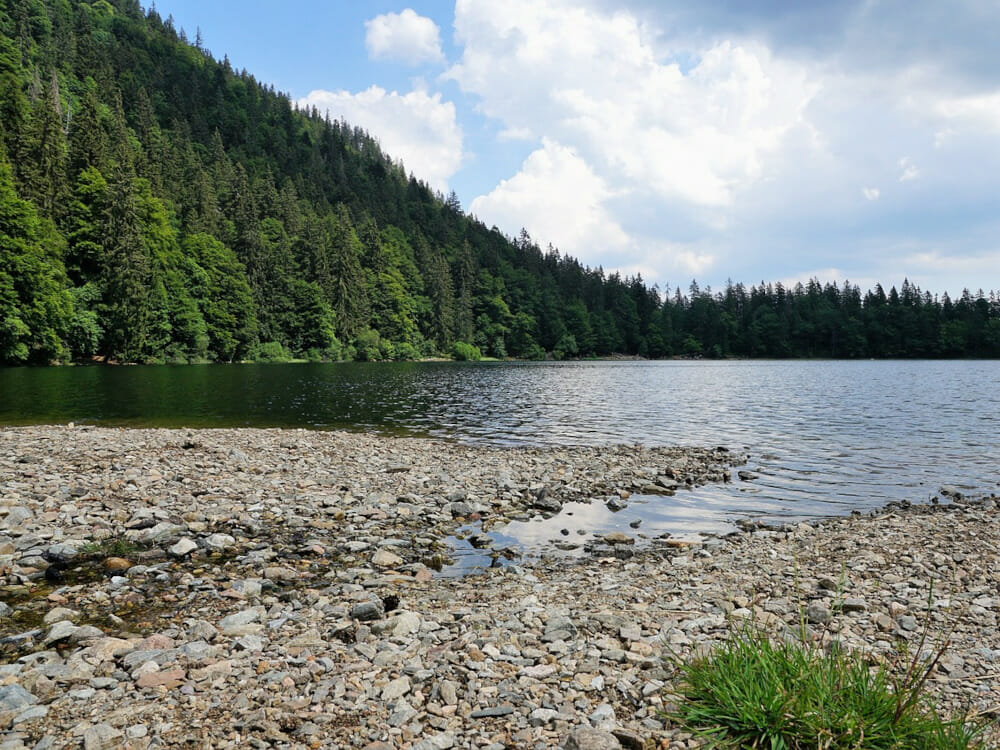
Zweribach Waterfalls
The Zweribach Waterfalls are situated in the idyll of a nature reserve. Start at the hikers’ car park close to Haldenschwarzhof Farm and walk for about 2 kilometres before reaching your destination. The water tumbles down into the valley via two large plateaus. The path is rocky as well as steep and not much wider than a beaten track in some places. Therefore, surefootedness and sturdy footwear are an absolute must.
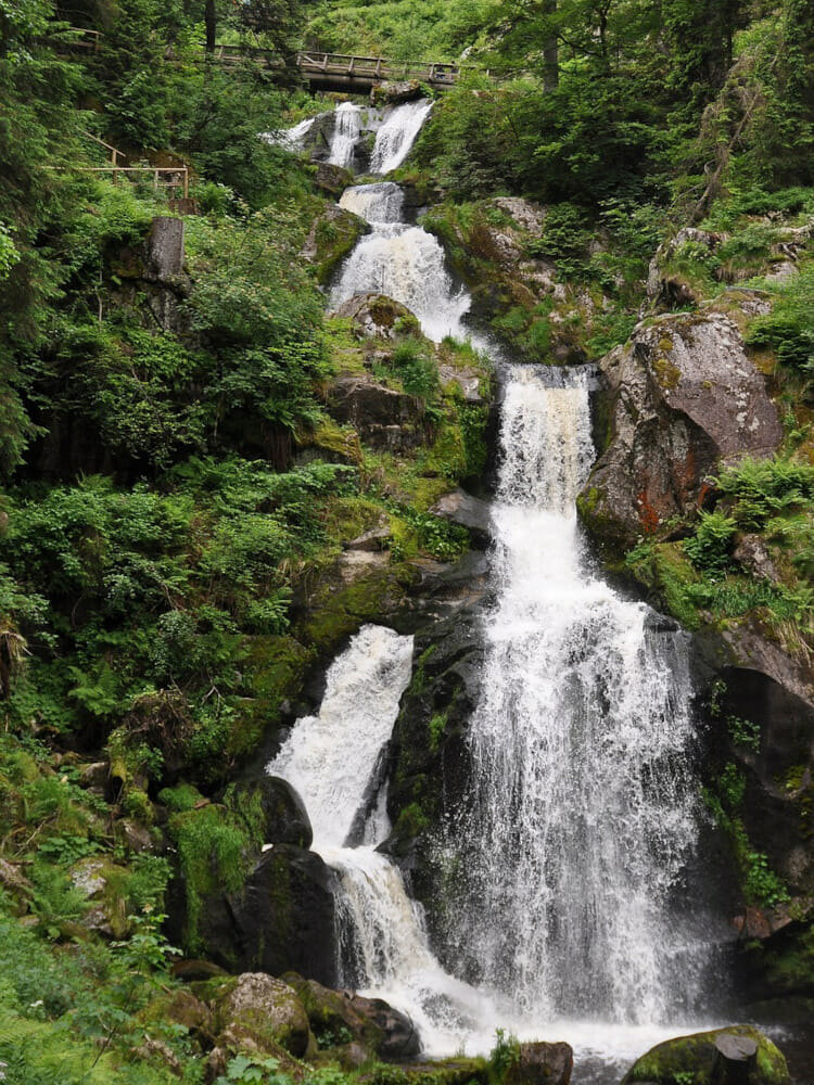
Triberg Waterfalls
The water of the Gutach thunders down 163 metres into the valley over a series of seven steps. The main entrance to the waterfalls is quick and easy to reach on foot from Triberg town centre. The waterfalls are illuminated in the evenings until about 10 p.m., giving them a fascinating appearance. That’s definitely worth the entry fee.
Todtnau Waterfall
In the Upper Black Forest, between Todtnauberg Mountain and Aftersteg, Todtnau Waterfall crashes down an impressive granite massif at a height of 97 metres. Access to the waterfall is barrier-free from Aftersteg car park at the Waterfall Portal, with the track rising slightly for the 500 metres to its destination.
If you want to extend your Black Forest hike, you can follow Genießerpfad – Wasserfallsteig Trail. The starting point is Wiesenquelle car park close to Hebelhof. The trail is about 12 kilometres long and leads you via the Hebelwegle Path and Feldberg Path to Fahl and Fahl Waterfall. Initially, you’ll go through the town of Brandenberg, via Wolfsschlucht Gorge and on to Todtnau Market Square. After that, it’s uphill to Todtnau Waterfall. The trail ends in Todtnauberg.
Todtmoos Waterfalls
The Todtmoos Waterfalls are located between Todtmoos and Hintertodtmoos. A signposted hiking trail leads you to the highest of these waterfalls, measuring 7 metres. From Todtmoos town centre, it’s 2.4 kilometres to the waterfall.
Highlights and sights in the Black Forest
Hochburg Emmendingen Castle
At a width of 250 metres, Hochburg Emmendingen is one of the largest castle buildings in Baden. It towers above the forest and vineyards, and the ascent takes you through gates and across moats. Once you’ve arrived at the top, you’ll be rewarded with a spectacular view. The Castle Museum can usually be visited on Sundays and public holidays.
Kastelburg Castle Ruins
The ruin is the symbol of Waldkirch. Kastelburg Castle was built between 1250 and 1260 by the lords of Schwarzenberg. It was used to defend Waldkirch. These days, it’s freely accessible, and when you’ve reached the top, you can climb the castle tower. You’ll get a great view of Waldkirch and Elztal Valley from there. Along the Knights’ Path to the castle, you can learn about life in medieval times.
Tatzmania Zoo and Theme Park
At Tatzmania Park close to Löffingen, you can see wild animals such as ibexes, wolves, tigers, lions, wallabies, zebras and monkeys. There are also rides, a barefoot path, a beer garden and a restaurant. You certainly won’t get bored.
Freiburg Cathedral and Botanical Gardens of Freiburg University
If you’re taking a trip to Freiburg, you should visit Freiburg Cathedral which is built of sandstone. It’s mainly known for its unique collapsed spire. Inside the church, you’ll see medieval art such as altars, stained class and sculptures. The cathedral came through several wars almost unscathed, in particular the two wars of the 20th century. 209 steps take you up the cathedral tower. At the top, you’ll get a great view of the city.
The Botanical Gardens have existed for 400 years, featuring medicinal, useful and mountain plants as well as various types of grape outside. In the large greenhouses, you can marvel at even more plants. The four greenhouses are divided into four themes: there’s the fern building which also houses living fossils, the tropical building, the French-Guyana building and the succulents building with cactuses and euphorbias. In the French-Guyana building, different vegetation zones from the countries of French-Guyana, Surinam and Guyana are presented. For plant enthusiasts, a visit to the Botanical Gardens is an absolute must!
Lichtentaler Allee
Lichtentaler Allee is a magnificent park and gardens in Baden-Baden. Created as an avenue of oak trees in front of the historical theatre in 1655, it used to be a coach path surrounded by meadows and fields. Today, it’s one of the most popular promenades in the world. Be enchanted by the magnificence of ancient trees, richly decorated bridges, imposing hotels and elegant villas along the avenue.
Vogtsbauernhof Open-air Museum
The open-air museum close to Gutach shows what life used to be like in the Black Forest. The circular walk features typical buildings from the 17th and 18th century, some of which still stand in their original locations. You can take part in workshops outdoors or in the museum workshop that are run by staff dressed in traditional Black Forest clothing. It’s a great way of delving into the past and getting to know Black Forest culture better.


